DroneMapper Image Processing, Precision Agriculture and GIS Services
DroneMapper.com. is a Colorado based company specializing in the generation of geo-referenced Orthomosaics and Digital Elevation Models from aerial images obtained by UAVs and/or manned aircraft. They operate an innovative Software as a Service (SaaS) system that allows UAV (drone) or manned aircraft pilots to upload and manage their imagery processing through this web based interface. They also offer extensive imagery consulting, desktop photogrammetry software, data management, data cleanup, software development and GIS services to customers and business partners. Additionally, DroneMapper offers the following mapping software.
 |
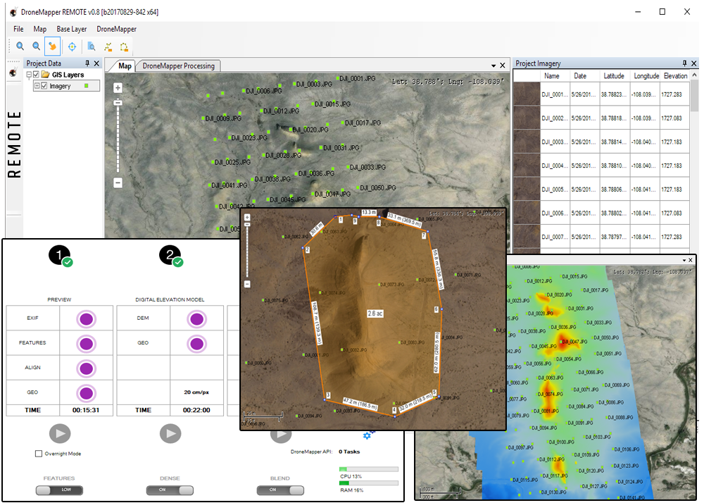
DroneMapper REMOTE allows the operator to process imagery from any sensor with a maximum input of 400 images. REMOTE produces Digital Elevation Model and Orthomosaic maps in GeoTIFF format, WGS84 Lat/Lon projection. The operator has the ability to select different output resolutions and ortho blending options at their discretion. The preview orthomosaic function provides near real time feedback at the site prior to packing equipment and discovering later that there was a collection issue. Forget the time and hassle of transferring your imagery to the cloud. REMOTE is the ideal tool for imagery processing, flight/data collection QA and light processing workloads on a laptop or desktop work station. REMOTE customers receive direct support from DroneMapper and our forums.
|
 |
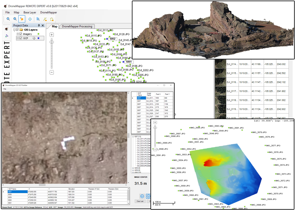
DroneMapper REMOTE EXPERT provides imagery processing from any sensor with a maximum input of 1000 images. REMOTE EXPERT produces Digital Elevation Model and Orthomosaic maps in GeoTIFF format. WGS84 Lat/Lon and UTM projections are supported. The operator has the ability to select different output resolutions, ortho blending and 64-bit point cloud generation. Forget the time and hassle of transferring your imagery to the cloud. REMOTE EXPERT includes Ground Control Point processing functionality and our GCP creation tool. In addition, REMOTE EXPERT includes advanced feature extraction and computer vision algorithms for difficult scene construction. REMOTE customers receive direct support from DroneMapper and our forums.
|