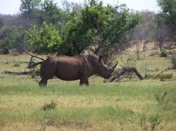
As CEO of LabWare, a global technology company that develops software for automating laboratory operations, Vance Kershner spent a lot of time in South Africa, where he quickly fell in love with its bush country and wildlife. In TKTKT, he started the Madikwe Conservancy, which today holds more than six thousand animals, including antelope, giraffes, impala, zebra, warthogs and white rhinos.
Unfortunately, the Conservancy’s armed guards face a number of challenges keeping poachers away. First, it can be difficult to detect where white rhinos are at any one time. “You can patrol for miles and encounter nothing,” says Kershner. Detecting poachers can be difficult if they’re hiding in the bush, particularly at night. If the guards detect suspicious activity, conveying an exact location to authorities in the middle of bush country can be a challenge.
Faunce also found UAV-America to help design and acquire the entire solution and integrate all the pieces so they would work together smoothly. “Owner Jim Cooper and his partner Matt Koestner picked up on what we were looking for right away and had very intelligent answers and suggestions,” says Faunce. “They were always very responsive.”
UAV-America provided the UAV and design support to choose and integrate the right flight controller, gimbal mount, transmitter, cameras, thermal imaging and other components with the UAV. The firm had a relationship with a distributor for FLIR, the obvious vendor of choice for thermal imaging. “In our experience that type of relationship is hard to come by,” says Faunce.
UAV-America found a robust controller solution with a radio that works up to a range of up to 110 Kilometers (manufactured by Thomas Scherrer Long Range Systems), allowing the user to patrol remotely from a long distance. It also can be programmed with a flight plan in advance. Specialized antennae came from Video Aerial Systems in Virginia. Low and high pass filters were necessary to prevent interference with the UAV’s GPS. Video streaming is provided by a 1.28 GHz frequency transmitter, which can transmit over the long distances required.
“We’re not committed to any one vendor or manufacturer,” says Cooper. “For the rhino project, we spent quite a bit of time researching, assembling and testing control and video streaming equipment to be sure they would meet mission requirements.”
Thanks to the innovative package, the preserve will soon have an efficient, low-cost solution for aiding patrols in locating white rhino on the preserve. Thermal imaging can identify poachers even if they’re hiding in the bush at night. A built-in GPS allows pilots to communicate exact coordinates if suspicious activity is detected. Kershner also anticipates using the UAS solution for the preserve’s annual aerial surveys and game counts, which until now required renting a helicopter for upwards of $10,000 per day.
Testing has begun in New Hampshire and will move to New Jersey for some limited flying and then a field test in South Africa during the first week in August.
“It’s amazing what a UAV can do for a relatively low price,” says Faunce. “You can set up a flight path, take your hands off and watch the camera transmission and the UAV’s location on a Google Earth Map. If you see something you can have it descend and hover over the area and then take off again. Everything works together like a charm.”
Cooper and Koestner have both found the experience with the Conservancy to be its own adventure. “Taking on projects that haven’t been done before and have no clear-cut solution at first is what I find the most rewarding,” says Koestner.


